LEWES, Del. (April 22, 2021) — The Delaware Forest Service plans to conduct a 48-acre controlled burn in the City of Lewes on Friday, April 23, beginning around mid-morning. The burn area will be closed to the public. Signs will be posted on nearby roads before and during burning. Residents and visitors may see or smell smoke but should not be alarmed. If you encounter smoke on the highway, slow down, turn on your vehicle’s lights and drive appropriately for the conditions. People are kindly asked to not visit the area as a precaution and to allow the crew to control the burn safely.

The 48-acre site is primarily coastal marsh with phragmites and other vegetation. The purpose of the burn is to reduce hazardous fuel buildup and restore native marsh habitat. The area was last burned in 2008. The area has been treated several times over the past ten years to control phragmites, (Phragmites australis), which outcompetes native vegetation and lowers the local plant biodiversity.
“This burn is vital to reduce the fuel threat in City of Lewes to help ensure that a large wildfire does not occur in the future,” stated Kyle Hoyd, Delaware’s assistant state forester who directs its wildland fire program. “Over the long term, we hope to engage with our natural resource partners in a careful process to help restore the area’s native habitat.”
Prescribed burns – also known as “Rx burns” – are an effective tool for a variety of land management objectives: site preparation, hazard fuel mitigation, invasive species control, and wildlife habitat enhancement. Low-intensity controlled fires can reduce the danger of a high-intensity wildfire in the future. A prescription is a set of conditions that considers the safety of the public and fire staff, weather, and probability of meeting the burn’s overall objectives. Rx burns are only “prescribed” when the site conditions fall into pre-identified parameters that maximize safety and reduce smoke impacts. Important factors include temperature, fuel moisture, wind speed, direction, relative humidity, and proximity to adjacent structures and populations.
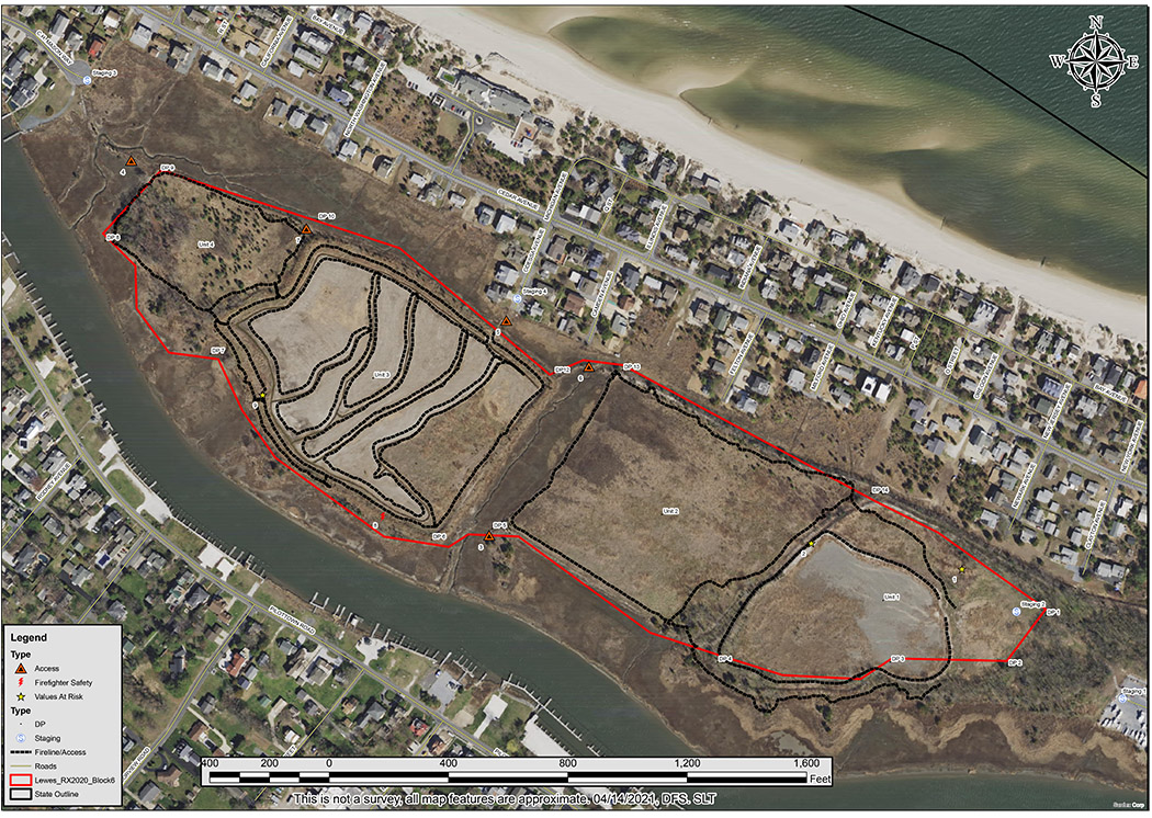
Overview of Lewes Rx Burn Plan and Site Map
As part of its wildland fire program, the Delaware Forest Service works with private landowners and other public agencies year-round to identify opportunities where burning might be an effective practice and then carefully develops plans to conduct the burn at the site. Last year, the agency completed burns on 158 acres but postponed projects involving another 379 acres, primarily due to the COVID-19 pandemic.
Contact info:
Kyle Hoyd, Assistant State Forester
Delaware Forest Service
kyle.hoyd@delaware.gov
302-698-4548 (office)
John Petersen, Community Relations Officer
Delaware Forest Service
john.petersen@delaware.gov
302-698-4552 (office)
302-653-6505 (Blackbird State Forest)
302-233-8180 (cell)