Severe Weather Awareness Week March 11-15, 2024

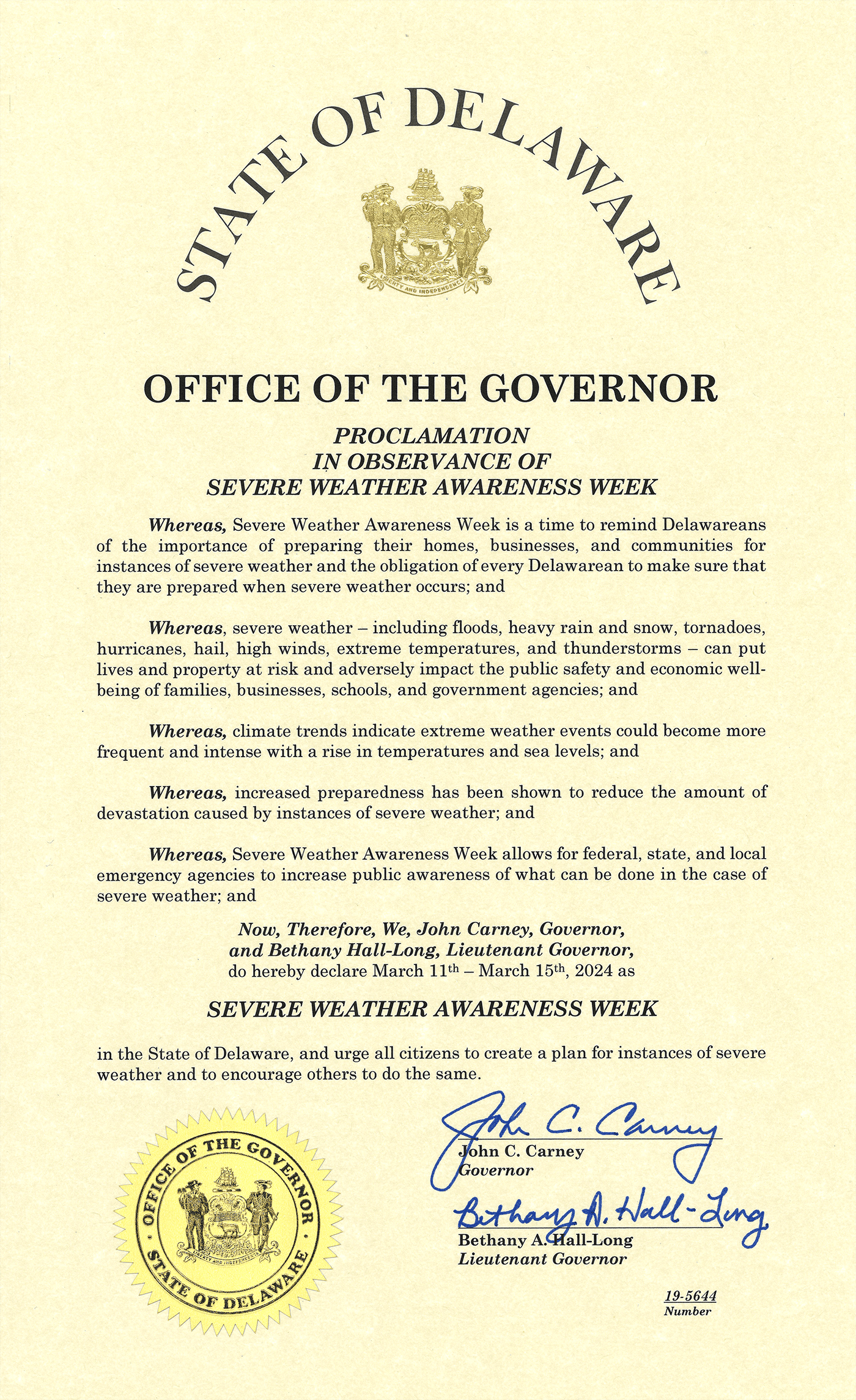
Governor John Carney and Lt. Governor Bethany Hall-Long have proclaimed March 11 to March 15 as Severe Weather Awareness Week in Delaware. In recent years, Delaware has experienced flooding, tornadoes, and coastal storms that put lives and property at risk and adversely impact the health, safety, and economic well-being of families, businesses, and schools. Learning about the different types of hazards can increase preparedness and reduce the devastation caused by severe weather.

The Delaware Emergency Management Agency (DEMA) is joining with the National Weather Service in Philadelphia/Mount Holly, NJ, the Center for Environmental Monitoring and Analysis (CEMA) at the University of Delaware, and Delaware Sea Grant to raise awareness. Flooding, coastal storms, tornadoes, and lightning are just some of the weather threats that can occur in Delaware, often with little warning. The National Weather Service is hosting a “Severe Weather Awareness Week” webpage with many informative resources and links to NOAA’s Weather-Ready Nation website. Tips on making a family plan, building a preparedness kit, and staying informed can be found at PrepareDE.org.

Delaware Emergency Management Agency Director A.J. Schall said, “Preparing for severe weather is important because it can reduce the risks of injury, death, and property damage. These weather events are becoming more frequent and intense. You can protect yourself and your loved ones by being informed, alert, and ready.”

Residents are urged to follow along on DEMA’s social media accounts for a different weather hazard each day, providing historical context as well as links to valuable information on how to keep your family safe.

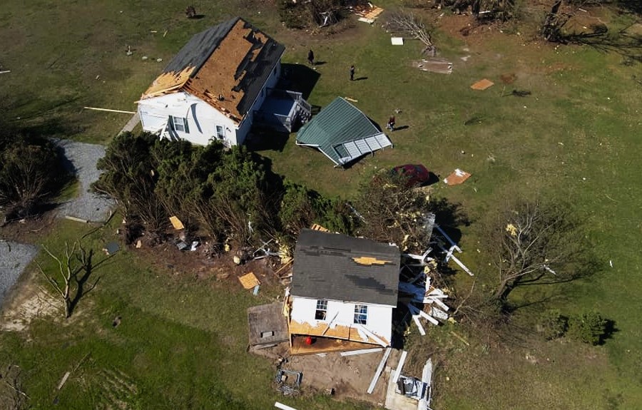
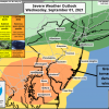
Delaware Severe Weather Awareness Week is a reminder that Delaware has been hit with many major weather events within the past four years. Record rainfall from the remnants of Hurricane Ida in 2021 caused historic flooding in parts of downtown Wilmington, Tropical Storm Isaias in 2020 spawned the longest tornado ever recorded in Delaware, which wreaked a path of destruction as it traveled from Dover in Kent County to Glasgow in New Castle County. This year also marks almost one year since a tragic tornado fatality occurred on April 1, 2023 in Sussex County. It was the first tornado-related death since two people were killed near a mobile home community near Hartly on July 21, 1983.

Nationally, NOAA reports that 2023 was the most historic and costly year on record for disasters. There were 28 weather and climate disasters in 2023 – surpassing the previous record of 22 in 2020 – causing at least $92.9 billion in damages. Experts believe extreme weather is increasing due to climate change while studies suggest that the human cost of climate-related disasters is acutely undercounted. A U.S. Census Bureau report estimated at least 2.5 million people were displaced by weather disasters in 2023. The University of Delaware Disaster Research Center – now celebrating its 60th anniversary – found disasters disproportionately affect low-income groups while widening existing inequities.

According to Kevin R. Brinson, Associate State Climatologist at the University of Delaware Center for Environmental Monitoring and Analysis (CEMA), average temperatures are generally increasing and precipitation is also getting more extreme. The intensity of tropical systems is also increasing as sea surface temperatures increase. Sea levels are definitely rising and the rate of rise could accelerate during the 21st century if large ice sheets continue melting in Greenland and Antarctica. Data shows that, on average coastal storms occur most often during March, but also are more likely in other months, such as May, August, September, and December. To check out Delaware climate records, visit the Delaware Climate Office Website. Scientists say it’s possible that climate extremes may become more common in future decades, particularly heat-related ones. Which is why being prepared for extreme weather is more important than ever:

“Our weather isn’t getting less extreme, so preparing for the next storm also prepares us for future extreme events,” Brinson said.

Insurance Check up

Flooding

Flooding is the most frequent and expensive natural disaster in Delaware and the USA and it can also be deadly. Over a 30-year period, flooding caused more fatalities on average than every other weather event except excessive heat. When a flood is imminent or occurring, the top priority should be the physical safety of family members and pets. Monitor local news and weather reports and sign up for emergency alerts. Have a communication plan ready in the event of a power outage. The best way to protect your home and belongings from flood damage is to buy and maintain home insurance and purchase flood insurance – don’t let your hard work and your family’s future be washed away. Experts recommend the following steps to prepare for a flood:

  • Buy and maintain home insurance and get a regular insurance checkup
  • Get information on flood insurance at FloodSmart.gov
  • Find out your flood risk at the DNREC Flood Planning Tool Website
  • Take a household inventory with photos and store important documents

Delaware Sea Grant is partnering with other agencies to host the “2024 Flood Insurance Forum: Fact vs. Fiction? Everything You Need to Know About Flood Risks and Insurance” on April 3, 2024 (in person and virtual) at the Lewes Public Library, from 9 to 11 a.m. For more information, contact Danielle Swallow at dswallow@udel.edu The public can register at www.deseagrant.org/flood-forum

Tornado Damage
Damage from the April 1, 2023 tornado that struck Sussex County, Delaware.

Tornadoes

Tornadoes are violently rotating columns of air that extend from a thunderstorm to the ground. Tornadoes can destroy buildings, flip cars, and create deadly flying debris. Tornadoes are not common in Delaware; however, when they do occur, they can cause serious property damage and threaten human lives. Tornadoes can occur anytime and anywhere, look like funnels and bring intense winds up to 200 miles per hour. Experts recommend the following steps to prepare:

  • Because tornadoes come with little or no warning, you should know the signs of a tornado: including a rotating, funnel-shaped cloud, an approaching cloud of debris, or a loud roar like a freight train.
  • Sign up for Delaware’s Emergency Notification System at de.gov/dens, download the FEMA mobile app, and enable local alerts for your area. Always follow the advice of state and local officials.
  • If your area is under a tornado warning, go to a safe shelter immediately, such as a safe room, basement, storm cellar or a small interior room on the lowest level of a sturdy building.
  • Stay away from windows, doors, and outside walls.
  • Do not go under an overpass or bridge. You’re safer in a low, flat location.
  • Watch out for flying debris that can cause injury or death.
  • Use your arms to protect your head and neck.If you can’t stay at home, make plans to go to a public shelter.

Find DEMA on Social Media: Facebook, X, Instagram, Youtube, Nextdoor


February 28 – March 4 is Severe Weather Awareness Week in Delaware

SMYRNA, DE: February 28th to March 4th is Severe Weather Awareness Week in Delaware.  Severe Weather Week Proclamation 2022.  From significant flooding to tornadoes and snowstorms, the past several years have seen active weather events across Delaware and throughout the region.  Knowing about the weather hazards and how to prepare can make a life-saving difference.  

The Delaware Emergency Management Agency (DEMA) is collaborating with the National Weather Service (NWS) in Mount Holly, New Jersey, the Center for Environmental Monitoring and Analysis (CEMA) at the University of Delaware, and Delaware Sea Grant to raise awareness.  Flooding, coastal hazards, thunderstorms, tornados, and lightning are among the weather threats to Delaware.  Links to information on these examples that could impact people in Delaware, sometimes without advance warning, can be found on a special “Severe Weather Awareness Week” National Weather Service webpage weather.gov/phi/demaseverewxweek.

The webpage also contains links to the National Oceanographic and Atmospheric Administration’s (NOAA) Weather-Ready Nation website.  Information on how to make a family plan and how to make a preparedness kit can also be found on the page with a link to preparede.org.  Follow along on social media as we cover a different weather hazard each day, providing historical context and tips for how to stay safe.

Severe Weather Awareness Week this year roughly coincides with the 60th anniversary of the Storm of ’62.  The devastating Ash Wednesday Storm in 1962 destroyed 1,932 houses along Delaware’s coast.  Capping off Severe Weather Awareness Week, Delaware Sea Grant, the Center for Environmental Monitoring and Analysis, and the Delaware Emergency Management Agency will be presenting, “Are You Storm Ready?  Insights from the Storm of ’62 and Other Extreme Weather Events in Delaware” on March 3, 2022 at 7:00pm.  This 90-minute virtual workshop will provide an overview of the Storm of ’62 in the context of more recent weather events, will discuss how to build storm readiness and resilience, and will provide emergency preparedness tips as well as a question-and-answer session with the experts.  The session is free of charge, but advanced registration is required.  To register for the free event, follow this link: https://www.deseagrant.org/events-all/2022/3/4/storm-of-62

Follow Delaware Emergency Management Agency on Facebook, Twitter, and Instagram.

Contact: Jeff Sands, Delaware Emergency Management Agency, 302-659-2211.


Severe Weather Possible Wednesday into Thursday

Updated 8/31/2021 at 6:00pm

Smyrna, DE – The Delaware Emergency Management Agency (DEMA) along with local, state, and federal partners, are closely monitoring the remnant low from Hurricane Ida.  We continue to coordinate with the counties and key state agencies to ensure readiness if the system worsens.  The main threats are anticipated to include rain, flooding, and severe thunderstorms.  A Flash Flood Watch is in effect for all of Delaware from Wednesday morning through Thursday afternoon.  Flooding is expected in creeks, streams, urban areas, and poor drainage areas.   There is an increased risk of severe weather for Delaware Wednesday evening and night including strong to severe thunderstorms causing downed trees and power lines, as well as increased potential for tornadoes.  Plan ahead now and be prepared.

  Event summary including potential threats of rain, flooding, severe thunderstorms, and tornadoes.Rainfall estimates from the storm ranging from 4 inches for New Castle County to 1 inch in Sussex County.Excessive Rainfall Outlook showing moderate risk (flash floods likely) and slight risk south of Dover. from Dover north, and Severe Weather Outlook showing most of Delaware in the Enhanced Risk category for severe thunderstorms and tornadoes.


How to Prepare:
  • Clear drains and gutters and check sump pumps
  • Never drive through flood water: Turn Around, Don’t Drown!
  • Be prepared to act if Tornado Warnings or other severe weather warnings are issued.

Make A Plan – preparede.org/make-a-plan

  • Make a plan for where you would go if you had to leave your home due to an evacuation or if it sustained damage.  Know how and where to shelter if a Tornado Warning is issued, go to Ready.gov/tornadoes for more.
  • Communicate and practice your plan with family.
  • Have a list of emergency contacts and copies of important documents.

Make An Emergency Kit – preparede.org/make-a-kit

  • Make sure that you have emergency supplies, such as food and water, for each member of your family (and pets) to last for at least 3 days.
  • Have flashlights in case of power outages and fully charged power banks to charge electronic devices.

Stay Informed

For more preparedness tips: PrepareDE.org
 
For weather updates from the National Weather Service: weather.gov/phi
 
For updates on the roads: https://deldot.gov/ and through their app https://deldot.gov/mobile/.
 
Follow Delaware Emergency Management Agency on Facebook, Twitter, and Instagram.
 
Contact: Jeff Sands, Delaware Emergency Management Agency, 302-659-2211.


DEMA Encourages Preparations for Tropical Storm Elsa

 Smyrna, DE – The Delaware Emergency Management Agency (DEMA) along with local, state, and federal partners, are closely monitoring Tropical Storm Elsa.  We continue to coordinate with the counties and key state agencies to ensure readiness if the system worsens.  A Tropical Storm Watch has been issued by the U.S. National Weather Service Philadelphia/Mount Holly for Sussex County with expansion of the Watch expected.  The updated track for Tropical Storm Elsa from NOAA NWS National Hurricane Center is slightly further west, which could mean a more significant impact for the state.  The main threats are anticipated to include rain, flooding, and increased rip currents beginning late Thursday.  But as we saw with Tropical Storm Isaias last summer, a variety of threats exist with Tropical Storms including tornadoes, high winds, flash flooding, etc.  Power outages are possible.  Plan ahead now and be prepared.

Prepare Your Home

  • Secure loose outdoor items such as grills, trash and recycling cans, and patio furniture.
  • Clear drains around your home to prevent flooding.
  • Trim back trees and bushes to prevent storm damage.
  • Have a plan for how to stay cool if the power goes out.
  • If you have a generator, make sure that you have fuel and test it in advance. Remember: never use a generator indoors!

Prepare Your Vehicle

  • Have a full tank of fuel
  • Ensure tire pressures are correct
  • Ensure that all lights are working.

Charge Electronic Devices

  • Keep phones, radios, and electronic devices fully charged in case of power outages.
  • Have portable power banks to charge electronic devices.

Make A Plan – preparede.org/make-a-plan

  • Make a plan for where you would go if you had to leave your home due to an evacuation or if it sustained damage.
  • Communicate and practice your plan with family.
  • Have a list of emergency contacts and copies of important documents.

Make An Emergency Kit – preparede.org/make-a-kit

  • Make sure that you have emergency supplies, such as food and water, for each member of your family (and pets) to last >3 days.
  • Have flashlights in case of power outages and fully charged power banks to charge electronic devices.

Stay Informed

Map showing the forecasted route of Tropical Storm Elsa which tracks through Delaware. Map showing the forecasted arrival of Tropical Storm force winds as early as Thursday evening.A map showing predicted rainfall of 1-2 inches or higher for Delaware.

For more preparedness tips: PrepareDE.org  

For weather updates from the National Weather Service: weather.gov/phi

For updates on the roads: https://deldot.gov/ and through their app https://deldot.gov/mobile/.

Follow Delaware Emergency Management Agency on Facebook, Twitter, and Instagram.

Contact: Jeff Sands, Delaware Emergency Management Agency, 302-659-2211.


Important Weather Information

School Closing Information System – Review a real-time listing of school closures from across the state of Delaware.


School Closing E-mail Registration Website – Subscribe to e-mail, text, and/or voice message notification of school closings and other school status.


School Closing Information by Phone – A voice activation system which provides school closing and other school status.
The toll free number is 877-831-7215.


Emergency and Adverse Weather Advisory – Read the latest information for state employees from the Human Resource Management Office.


State of Delaware BlackBoard Connect Closing/Delay Notification Registration – This service will allow you to sign up to receive information updates and advisories for Delaware State Government Employees.


State of Delaware BlackBoard Connect “How to Register Guide” – View instructions on how to sign up with BlackBoard Connect to receive advisories for Delaware State Government Employees.


Live Traffic Cameras – Take a look at where the traffic is heading and have a bird’s eye view of the clear paths to get you where you need to go.


Online Subscription Service – Receive DelDOT press releases, scheduled travel restrictions, and real-time travel advisories via e-mail.


DelDOT’s Snowplow Tracker – available on the DelDOT mobile app or on their website.


Subscribe on News.delaware.gov – sign up to receive emails when state agencies like DelDOT, DEMA, or the Governor’s office post press releases about weather announcements.


When the weather turns especially hazardous, Delaware has a three-level system of driving warnings and restrictions. Drivers should know the three levels and what they mean.

The levels are found in Title 20 of the Delaware Code, Subsection 3116(b)(12) and may be put in effect by the Governor during a State of Emergency for all or parts of Delaware based on conditions.


Level 2 Driving Restriction: essential personnel include those who are necessary state personnel or those who provide healthcare services, food deliveries, and fuel deliveries during a state of emergency in both public and private industries.  


Level 3 Driving Ban: includes first responders, some state employees (i.e. policemen, utility workers), people the governor has approved through executive order and operator of snowplows or debris removal equipment that have been hired by the state or private interests.