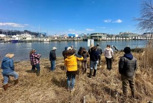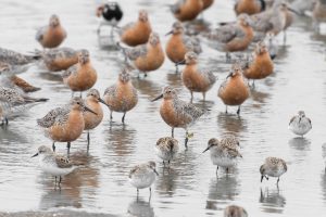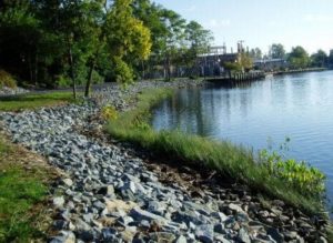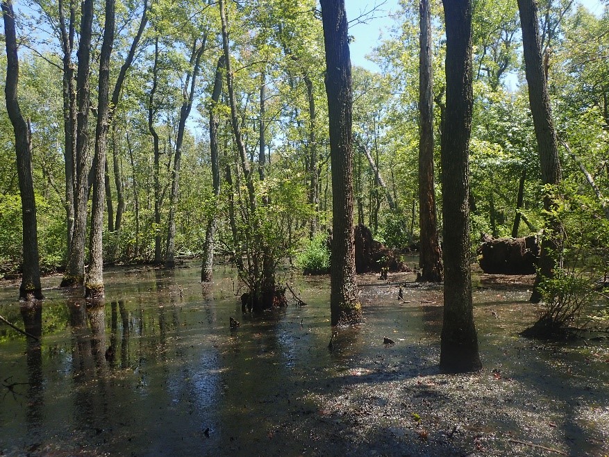
Chester-Choptank Wetland/DNREC photo
The Department of Natural Resources and Environmental Control has finalized a report card on the health of wetlands within the Delaware portion of the Chester-Choptank watershed, with the wetlands earning an encouraging B grade but with recommendations for improvement. Published by the DNREC Wetland Monitoring and Assessment Program (WMAP), the report card covers the Chester-Choptank watershed, a combination of several watersheds, including Sassafras River, Elk River, Chester River, and Upper Choptank River. The Delaware part of the watershed resides in New Castle and Kent County, where it encompasses 113,944 acres (178 square miles) of land.
Of Delaware’s many watersheds, only the Chester-Choptank feeds into the Chesapeake Bay. During the summer of 2018, environmental scientists from the DNREC Division of Watershed Stewardship collected data on the plants, hydrology and wetland buffer disturbances from 76 sites within the Delaware portion of the Chester-Choptank watershed. Using these condition assessment checklists and biological metrics, they assessed the wetlands in the watershed to be in fair condition, falling in the middle of Delaware watersheds previously rated by DNREC. The WMAP scientists found the most common stressors to the Chester-Choptank to be selective tree cutting and invasive plants; ditching for added drainage and microtopographic alterations; and channelized waterways and development.
The report found that approximately 35% of the land area of the Chester-Choptank watershed is currently covered by wetlands. WMAP performed freshwater assessments in 30 flat wetlands, 27 riverine wetlands, and 19 depression wetlands using the Delaware Rapid Assessment Procedure (DERAP) Version 6.0, a data collection method created by DNREC environmental scientists (and available for use by professionals and the public alike). No tidal wetlands were assessed because the watershed comprises a headwater region of the Chesapeake Bay, which means it is too far inland for the presence of tidal wetlands.
DNREC’s data was used to create a technical report and a more user-friendly “watershed report card” that summarized not only the health of the Chester-Choptank watershed’s wetlands, but also examined the change in wetland acreage in recent decades; what value the wetlands provide; and how recent changes in land use will impact wetlands in the future.
In assessing it, WMAP estimated that by 2007, 39% of historic wetland acreage in the watershed had been lost, mostly due to land conversion such as development. Impacts to wetland health reduce a wetland’s ability to perform fully, diminishing its valuable role in controlling flooding and erosion; improving water quality; storing excess rainwater; and providing ecosystem services for both people and wildlife.
Based on the results of this study, DNREC made recommendations targeting scientists, public decision makers and landowners toward improving and enhancing the future health of Delaware’s wetlands. These recommendations included maintaining adequate wetland buffers, restoration activities, increasing education and outreach, using best management practices, suggesting that landowners protect wetlands on their property, and improving the protection of the watershed’s non-tidal wetlands for the future.
The wetland reports by the DNREC Wetland Monitoring and Assessment Program are funded by the U.S. EPA’s Region 3 Wetland Program Development. They are supported by the DNREC Nonpoint Source program, which shares data, best management practice (BMP) issues, and insight into the challenges within the Chesapeake Bay region. For more information about the Chester-Choptank watershed, please visit https://dnrec.alpha.delaware.gov/watershed-stewardship/wetlands/assessments/chester-choptank/.
About DNREC
The Delaware Department of Natural Resources and Environmental Control protects and manages the state’s natural resources, protects public health, provides outdoor recreational opportunities and educates Delawareans about the environment. The DNREC Division of Watershed Stewardship develops and implements innovative watershed assessment, monitoring and implementation activities. For more information, visit the website and connect with @DelawareDNREC on Facebook, Twitter or LinkedIn.
Media Contacts: Joanna Wilson, joanna.wilson@delaware.gov; Michael Globetti, michael.globetti@delaware.gov
###